Resolution Copper Map
showing the impact boundaries of the subsidence caused by their proposed mining operations—a crater the size of "Meteor Crater." (Meteor Crater is nearly one mile across, 2.4 miles in circumference and
more than 550 feet deep.)
What the map does not show is how much of the region will be dewatered because of pumping water to keep a 7,000 ft. undergrond pit, which will extend one mile in diameter from 5,000 ft. to 7,000 ft., dry enough for mining operations.
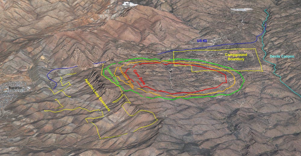
Red = Cave Zone above the pit
Orange = Fracture zone to stabilize the walls of the pit
Green = Intact zone
Yellow = Oak Flat and Apache Leap Easement
Turquoise line (on far right) = Path of Devil's Canyon
Dark Blue line = Path of Queen Creek