Do the proposed lands for land swap adequately replace these sites?
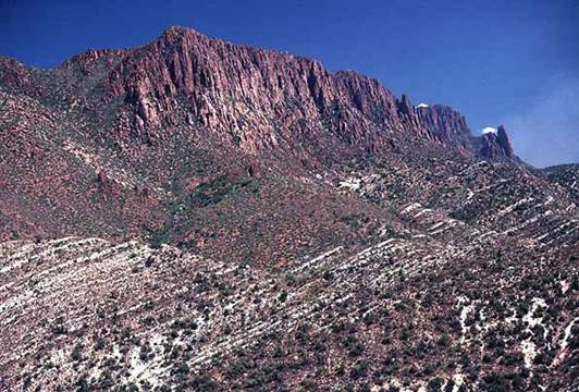
Historic and Sacred Apache Leap
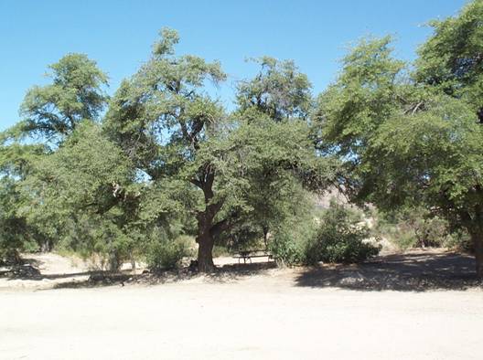
Wonderful Oak Flat Campgound
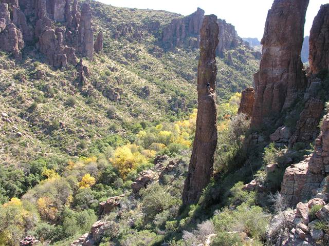
Devil's Canyon in Autumn color Photo by Charles Babbitt
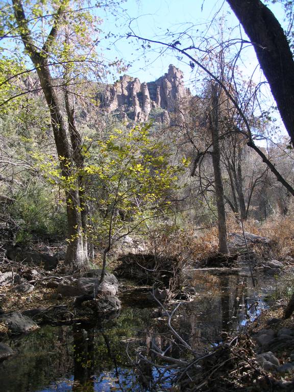
Devil’s Canyon Riparian Area Photo by Lisa Fitzner
These are the properties Resolution Copper Co. proposes to swap the federal government for the 3,025-acre Oak Flat parcel east of Superior:
The values of over-grazed ranch lands, which Senator McCain jokingly referred to as “national treasures,” have been over-rated. Further, “old growth,” that is “original growth” in its usual meaning, mesquite forests do not exist. Traditionally, southwest Arizona was covered with grasslands. Ranchers came in during the late 1800’s and by the early 1900’s had destroyed the natural grasses. They also cut down trees along the river banks to plant alfalfa for their cattle. Mesquites only grew along dry washes. West Texans call mesquite the “weed from hell.” Blogs exist on the Internet with questions, such as “How does everyone else get rid of these cursed things?” They are an inevitable result of ranching as the cows eat the beans because they have destroyed the grasslands. Then the cows distribute the beans far and wide with a cow paddy to give them a fresh start.
(1) to the Secretary of Agriculture, all right, title, and interest that the Secretary determines to be acceptable in and to--
(A) the approximately 147 acres of land located in Gila County, Arizona, depicted on the map entitled `Southeast Arizona Land Exchange and Conservation Act of 2009-Non-Federal Parcel-Turkey Creek' and dated January 2009;
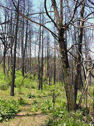
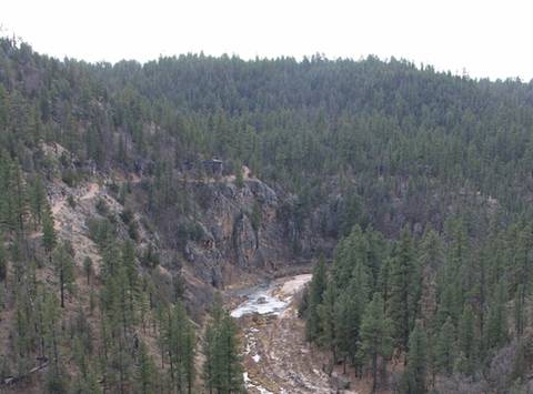
Three years ago the Pitcher Fire burned much of this 147-acre ranch including both its riparian hardwoods and the ranch’s adjacent ponderosa forest. With decades of overgrazing, one finds little unburned mature riparian vegetation here. The stream flow currently is intermittent (underground at times) with only a trickle on the surface, even after a record wet spring this year. The ranch's nearly impassible 4WD access road makes this property inaccessible to the general public.
(B) the approximately 148 acres of land located in Yavapai County Arizona, depicted on the map entitled `Southeast Arizona Land Exchange and Conservation Act of 2009-Non-Federal Parcel-Tangle Creek' and dated January 2009;
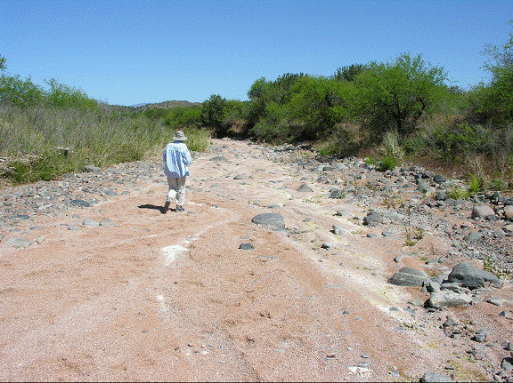
This ranch also has a bone-dry river bottom for the full one mile length of the ranch. It is devoid of sufficient water to support cottonwood, willow, sycamore or ash riparian vegetation even if it were over-grazed. Only three forlorn medium-to-small sycamores exist near the dry creek. There is one willow at a nearly dry, filthy, algae-filled stock pond near the abandoned homestead. Like the Cave Creek and Turkey Creek swap properties, this cattle-devastated parcel will continue to be grazed after it is traded to the Forest Service. The acquisition of this property is of little or no real benefit to the Tonto National Forest or the public at large.
(C) the approximately 149 acres of land located in Maricopa County, Arizona, depicted on the map entitled `Southeast Arizona Land Exchange and Conservation Act of 2009-Non-Federal Parcel-Cave Creek' and dated January 2009; [ie, 6L Ranch]
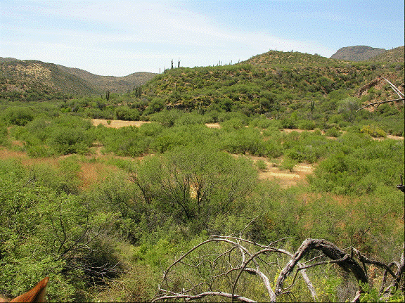
The property is limited in size, and heavily disturbed by past settlement and chronic overgrazing. The area’s rich archeological resources are protected by the defacto non-motorized access created by the Spur Cross Ranch Conservation Area to the South, and the forest lands that surround it on all sides. The existing resource values of the area will not change nor be enhanced as a result of a change in ownership. The acquisition of the 6L property is of little benefit to the Tonto National Forest or the public at large.
(D) the approximately 88 acres of land located in Pinal County, Arizona, depicted on the map entitled `Southeast Arizona Land Exchange and Conservation Act of 2009-Non-Federal Parcel-J-I Ranch' and dated January 2009;
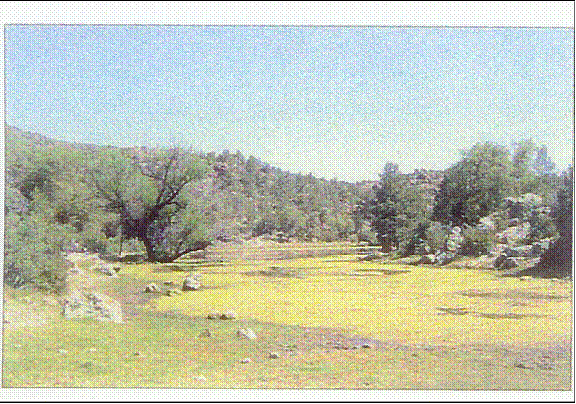
This ranch has hoof and cow dung impacted stock ponds and a brief half-mile ephemeral stream with mature sycamore and oak vegetation. One stock tank is described as "perennial" in Resolution Copper’s PR literature to Congress. They describe that pond as a site for a replacement campground for the Oak Flat Campground and that this "stock pond area would be highly desirable for dispersed camping opportunities." Resolution mis-describes that degraded stock pond and its one willow tree (the only riparian habitat tree species there) as "…habitat for a large array of birds…"
(E) the approximately 640 acres of land located in Coconino County, Arizona, depicted on the map entitled `Southeast Arizona Land Exchange and Conservation Act of 2009-Non-Federal Parcel-East Clear Creek' and dated January 2009;
It is claimed that one of the swap properties includes four miles of trout fishing. While East Clear Creek in this region undoubtedly has trout, the four or so miles of adjacent riparian miles of this ranch property is never fished. On four different visits at different times of the year, summer and winter, we never saw any fisherman. Reasons may include cattle riparian abuse, no water gaps to stop cattle, difficult access, remote and very poor roads. The Land Swap bill includes no money from Resolution to maintain, protect or fence or improve this highly abused cattle ranch property.
(2) to the Secretary of the Interior, all right, title, and interest that the Secretary of the Interior determines to be acceptable in and to—
(A) the approximately 3,073 acres of land located in Pinal County, Arizona, depicted on the map entitled `Southeast Arizona Land Exchange and Conservation Act of 2009-Non-Federal Parcel-Lower San Pedro River' and dated January 2009; [ie., Seven B Ranch]
This parcel of land is owned by BHP Copper Company and is under no duress for need of protection. In Arizona, the Copper Companies buy parcels of agricultural land in order to have the water rights. There is no danger of mining here, or developing homes here, because it is in a flood plain. This was an opportunity for BHP to unload this piece of property and for Nature Conservancy to collect some fees for managing it. There is one small perennial spring on the 3,000 acres, which creates a small habitat of about a city block in size.
Further, BHP does own another riverside parcel with riparian habitat. BHP does plan to develop homes in that area, some 35,000 units. As of this time, they have made no commitment to protect this riparian habitat. It would be foolish for the public to take the non-desirable dry riverbed for conservation, when next to it, BHP may endanger the true valuable river streambed that does have intermittent flow year around and a developed riparian system.
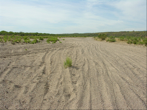
The San Pedro is not free-flowing at the 7B Ranch. The 3072 acre ranch consists of seven miles of bone dry San Pedro riverbed devoid of surface water. It is bereft of the San Pedro’s famously lush willow, cottonwood, ash, sycamore or walnut riparian groves! Any photos with water were taken during the two months of summer thunder storms. The west bank is ecologically sterile, consisting of the dying mining town of Mammoth and huge piles of tailings from the defunct copper mine. However, the dry bed does serve as a roadway for off-road vehicles.
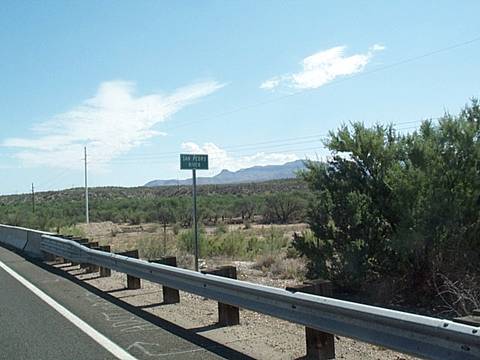
The dry San Pedro at 7B Ranch & Highway 77 crossing—looking south
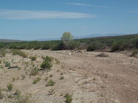
The lone cottonwood illustrates the lack of any typical riparian system—looking north from Highway 77
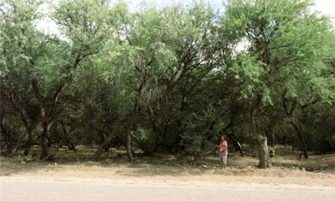
The 7 B ranch is no gift to the beleaguered San Pedro riparian ecosystem, despite its 800-acre, same-aged, monoculture of upland mesquite on its east bank. Only birds found in mesquite all over southern Arizona live here.
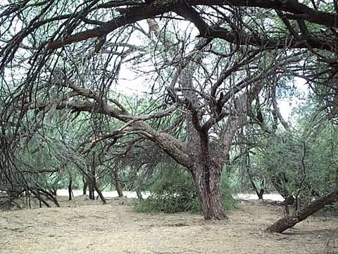
This is certainly no “old-growth” forest. This tree was the largest we could find with a 1 ½ foot diameter trunk. Trees may grow up to 4 feet (1.2 meters) in trunk diameter and live for several hundred years. As illustrated by the dead branches on this tree, since mesquites grow so prolifically, the older trees are crowded out from the thick shade. Most of the trees are less than 1 ft. diameter trunks, typical of the change from ranching to allowing the mesquites to take over during the past 50 years under BHP ownership.
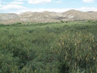
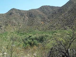
Mesquite Bosques are prevalent along Highway 77
(B) the approximately 160 acres of land located in Gila and Pinal Counties, Arizona, depicted on the map entitled `Southeast Arizona Land Exchange and Conservation Act of 2009-Non-Federal Parcel-Dripping Springs' and dated January 2009; and
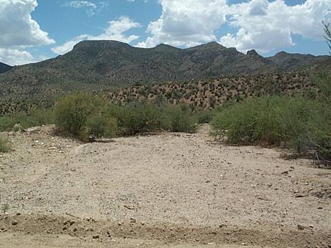
Dripping Springs is a dry wash that until 1970 was called Dumping Springs
There is no info available on this parcel. There is no dripping and no springs going on here. Dripping Springs is a 10 mile or so dry wash. Because of the lack of information in the Bill, it was not possible to ascertain which stretch of the dry wash was designated for public use. In any event, the area is studded with privately-owned small ranches. The Department of Interior stated in a previous Senate hearing that they do not have resources to manage the land, and that they would turn it over to the State of Arizona for a state park and campground. However, at this time Arizona has plans to close eight State Parks due to budget considerations. The time to travel here from Phoenix would be doubled—or more if the wash-board dirt road remains.
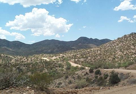
No one has volunteered to pay for a road to the site to replace the curving, wash-board dirt hilly road.
(C) the approximately 956 acres of land located in Santa Cruz County, Arizona, depicted on the map entitled `Southeast Arizona Land Exchange and Conservation Act of 2009-Non-Federal Parcel- Appleton Ranch' and dated January 2009.
The Appleton Ranch is a well-managed ranch with extensive grasslands. The only question: Is it isolated from other Bureau of Land Management lands, so that it will be difficult for them to continue its management.
Photos and commentary contributed by
Bob Witzeman
4619 E. Arcadia Lane
Phoenix, AZ 85018
602 840-0052
Home